|
- You'll always
return for another vacation in the Northern
Wilderness - |
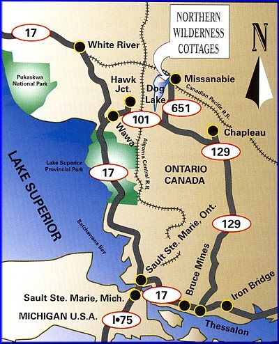
Directions
- In the U.S., take the quickest way north to Sault Ste. Marie, Ontario (Usually Interstate 75 through Michigan).
- Follow Highway 17 North to Wawa, Ontario.
- Once in Wawa, take Highway 101 East towards Chapleau (40 miles).
- Turn left onto Highway 651 North to Missanabie (35 miles).
- Once in town, drive through until you cross the railway tracks.
- Take
a quick right and follow the road between the railway and lake to the
end of the peninsula where you'll reach our base site.
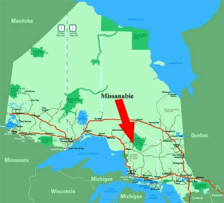
Approximate Driving Distances to Missanabie
| Miles | Kilometers | | Cincinnati | 775 | 1240 | | Cleveland | 720 | 1150 | | Columbus | 740 | 1175 | | Indianapolis | 750 | 1200 | | Toronto | 600 | 960 | | Chicago | 720 | 1150 | | Detroit | 560 | 895 |
|